Newcastle City Council
Tree preservation zone
There is a problem
- 1000 entries with tree-preservation-order field must match the reference field in the tree preservation order dataset
Jesmond Towers Estate
- reference
- 2011/003.W1
- name
- Jesmond Towers Estate
- tree-preservation-order
- 2011/003
- tree-preservation-zone-type
- woodland
- geometry
- MULTIPOLYGON (((-1.605120 54.998531,-1.605084 54.998530,-1.605086 54.998491,-1.604964 54.998476,-1.604754 54.998446,-1.604634 54.998420,-1.604585 54.998404,-1.604554 54.998384,-1.604535 54.998366,-1.604527 54.998349,-1.604518 54.998320,-1.604519 54.998298,-1.604470 54.998275,-1.604445 54.998256,-1.604428 54.998231,-1.604414 54.998198,-1.604400 54.998126,-1.604366 54.998054,-1.604339 54.998006,-1.604312 54.997981,-1.604291 54.997975,-1.604217 54.997961,-1.604156 54.997956,-1.604094 54.997954,-1.604054 54.997971,-1.603973 54.998016,-1.603899 54.998060,-1.604178 54.998089,-1.604194 54.998118,-1.604294 54.998326,-1.604375 54.998503,-1.604396 54.998524,-1.604427 54.998541,-1.605074 54.998680,-1.605120 54.998531)))
- point
- POINT (-1.604527 54.998353)
- notes
- These data are update live via a feed to NCC's Tree Managament System, EzyTreev
- entry-date
- 2022-07-01
- start-date
- 2011-11-10
- end-date
How to fix this issue
Your data is missing a tree-preservation-order.
The tree preservation zone guidance explains how to fix the issue:
tree-preservation-order
The reference for the tree preservation order that covers this zone.
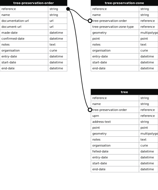
How to improve Newcastle City Council’s data
- Fix the errors indicated
- Use the check service to make sure the data meets the standard
- Publish the updated data on the endpoint URL